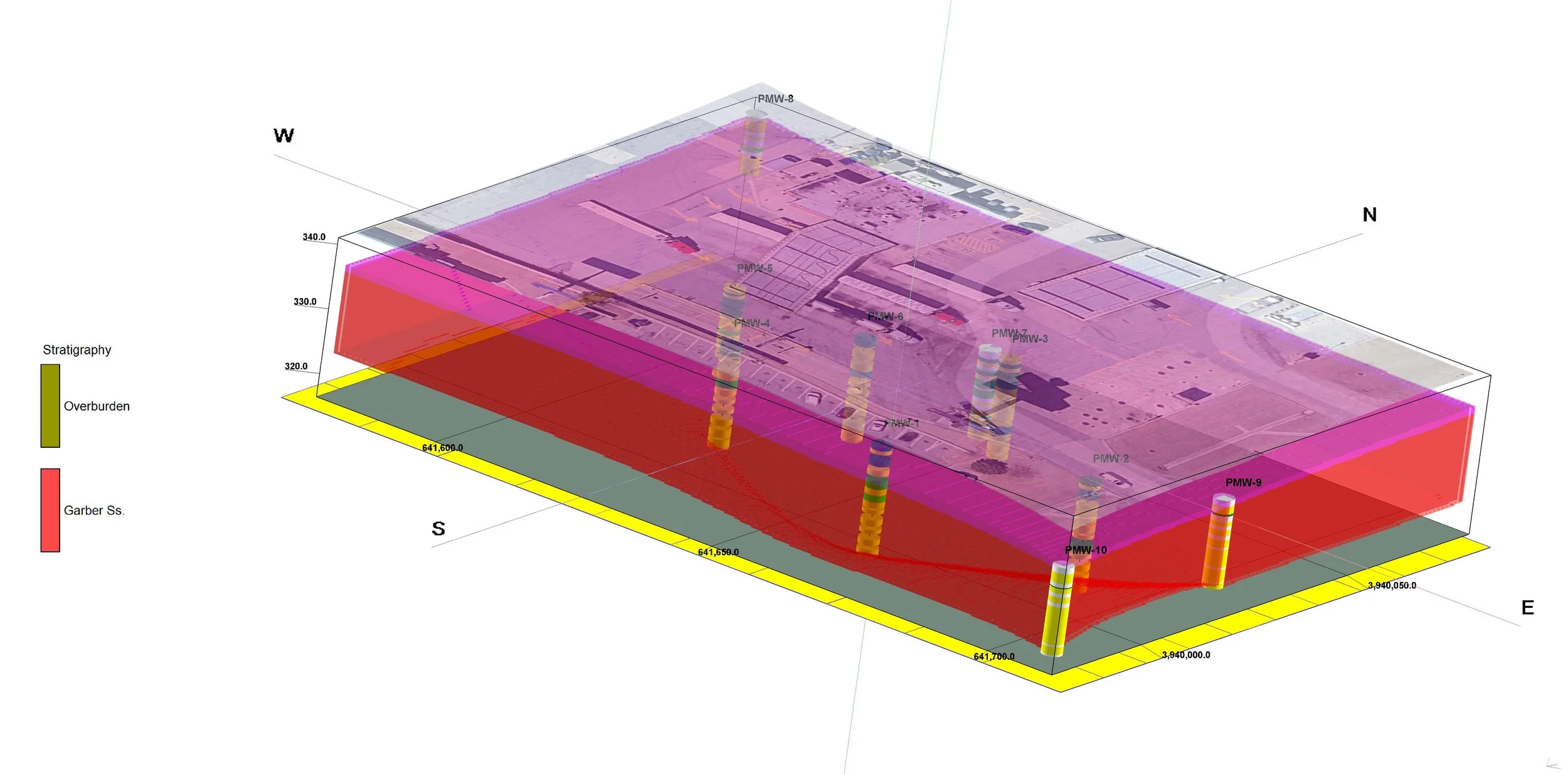
Understanding what lies beneath a contaminated site requires more than a set of boring logs. It requires taking all of the available data and building a coherent picture of how the subsurface is structured. At The Phoenix Group, our geologists use advanced modelling software to create visual representations of subsurface conditions, giving clients and regulators a clear view of what's happening below the surface.
Geological modeling services at The Phoenix Group integrate soil logs, groundwater data, and geophysical survey results to create accurate lithologic cross-sections and plume boundary maps. We incorporate electrical resistivity survey data to confirm how materials change with depth and lateral distance, and we use that information to produce geologic models that reflect the actual conditions at each specific site.
Every geologic model is designed to support something practical. Whether that's a remedial action plan, a regulatory closure report, or a geotechnical evaluation, the model gives everyone involved a common reference point for understanding the site and making decisions. Well-built geologic models reduce uncertainty, focus remediation resources where they're needed, and support faster regulatory review.
Geologic modelling also helps when site conditions are more complicated than they first appeared. Sites with multiple soil layers, discontinuous sand channels, perched water zones, or interfering utility corridors present interpretation challenges that can't be solved with boring logs alone. The model integrates all of the available information and makes the complexity visible in a format that supports sound decisions. That matters especially when you're trying to explain to a regulator why a plume has behaved unexpectedly or why a particular remedial approach is appropriate for this specific subsurface. A well-supported geologic model turns a complicated site into a defensible one.
Our geologists approach every geologic model as a working tool, not just a deliverable. As new data comes in from additional borings, monitoring events, or geophysical surveys, the model gets updated to reflect what's actually happening below the surface.